Historic Maps for sale
We offer personalized replica maps of your neighborhood from three different years: the 1906 Atlas, a 1926 tax map, and a 1906 Map of Downtown Montclair. Posters are printed on high-quality paper, suitable for framing, identify the map source and year, and are personalized for your address.


Close up
Personalized 1906 Atlas Map
This beautiful 1906 Atlas divides Montclair into seven “Plates,” each of which focuses on a specific part of town. Was your house built by then or was the lot still pastures? Was the street even there? Who owned the property? Was there a dairy, a farm, or a mill nearby?
You give us the address, and we’ll find the map in which it’s shown. At the bottom of the map, we’ll include your address, along with the information about the Atlas.
Poster size is 24” x 36.” $150
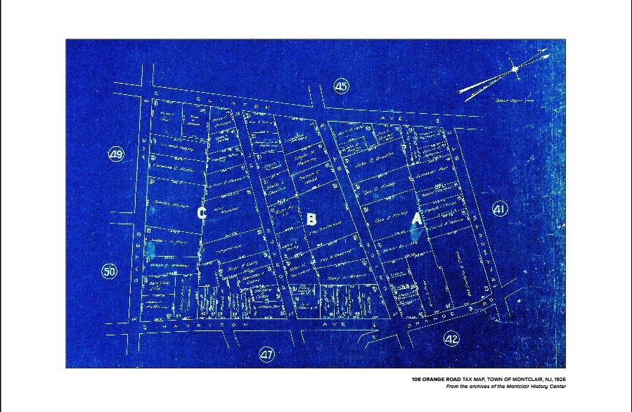
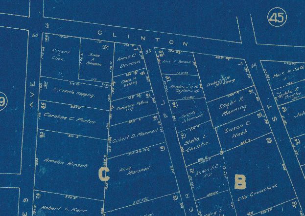
personalized 1926 Tax Map
Although tax maps come out regularly, we chose 1926 because it’s so unique. It’s a vivid bright blue with white type, much like an architectural blueprint. Each map covers about five or six blocks and lists the streets and property owners.
Tell us the address you want featured when you’re checking out and we’ll find the right one in the tax map book.
Poster size is 18” x 24.” $125


Close up
1906 MAP of Downtown Montclair
With a nod to the importance of the railroad to Montclair’s history, this map (Plate 24) zeroes in on the area around Lackawanna Station. Unlike the other maps we offer, this one is not personalized.
It’s a perfect present for a long-time Montclair resident, a new Montclair resident, or a Montclair resident at heart.
Poster size: 24” x 36” $95