Republished from: Montclair Neighbors. September 2019
Written by David Fox, MHC Trustee
Montclair residents saw a great deal of transition and turmoil in the 27 years between 1906 and 1933: the beginning and end of the First World War, the ratification of the Eighteenth amendment prohibiting the manufacture and sale of liquor (and its repeal in 1933 with the Twenty-first Amendment), the Nineteenth amendment which granted women’s suffrage, the rise in popularity of the automobile, film, and radio. We can illustrate some of these changes by comparing the 1906 and 1933 editions of the Atlas of Essex County, both of which can be found in the Montclair History Center’s research library and online digital collections.
Particularly relevant to any discussion of the 1933 Atlas is the fact that Montclair nearly doubled in population between 1910 and 1940 (from ~21,000 to ~40,000). We can attribute this growth, in part, to the Great Migration, during which millions of African Americans relocated from the rural South to the Northeast, Midwest, and West. Foreign immigrants—from Italy, Eastern Europe and elsewhere—also arrived in Montclair during these years.
Using selections from the 1906 and 1933 atlases, we can demonstrate this rapid growth. Here are a few blocks, along Orange Road in Montclair’s South End. Blocks which in 1906 boasted no more than a handful of houses are suddenly busy neighborhoods of 20 or more homes. This same housing boom can be seen throughout Montclair.

Atlas of Essex County New Jersey. 1906. Plate 22
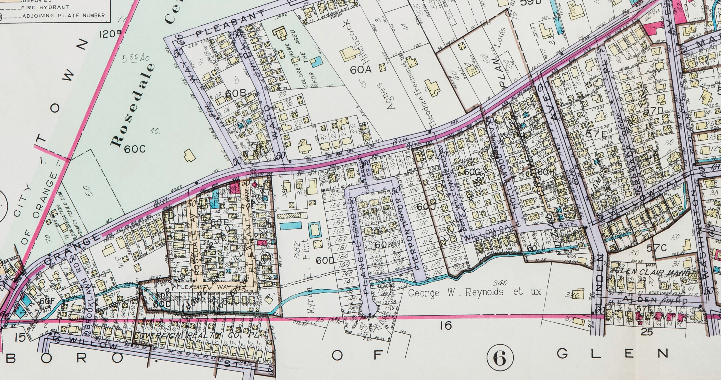
Atlas of Montclair, Glen Ridge, Cedar Grove, and Verona. 1933. Plate 5
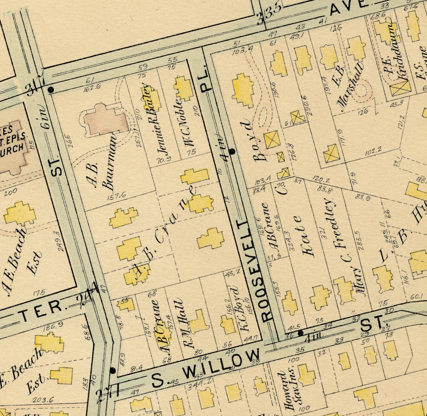
Montclairians also found homes in apartment buildings that had been introduced into the town in the first few decades of the century. In general, the idea of a shared living space—that was not a tenement, that might actually provide safe and comfortable shelter—was a relatively new concept to Americans. Montclair seems to have embraced the idea wholeheartedly. The 1906 Atlas does not appear to denote any apartment buildings whatsoever, but in 1933 they proliferate. Here, in just one small corner of Montclair, east of South Fullerton and west of South Willow, look for Union Apartments, Roosevelt Apartments, Clairview Apartments, and others in the 1933 selection:
Atlas of Essex County New Jersey. 1906. Plate 24

Atlas of Montclair, Glen Ridge, Cedar Grove, and Verona. 1933. Plate 2
Following the First World War, rising earnings and the mass production methods pioneered by Henry Ford, put car ownership within reach for many more consumers. Car shoppers in Montclair had plenty of options. There was Ford, of course, and Dodge, Plymouth, and Chrysler. But also a few less familiar brands, all of which are defunct now: Nash (known for introducing the seat belt), DeSoto, and Packard.
Between 1906 and 1933 the area around today’s Lackawanna Plaza became something of a hub for car dealerships. Also note the addition of Lackawanna Terminal, built in 1913 (accompanied by the renaming of Spring Street to Lackawanna Plaza).

Atlas of Essex County New Jersey. 1906. Plate 24

Atlas of Montclair, Glen Ridge, Cedar Grove, and Verona. 1933. Plate 1

Atlas of Montclair, Glen Ridge, Cedar Grove, and Verona. 1933. Plate 2
This new middle class also sought more leisure activities: movies, radio, and theater grew in popularity. In 1913 the Montclair Theatre opened at the corner of Valley Road and Bloomfield Avenue—it held films and stage productions, including a revival of Diamond Lil with Mae West in 1948. In 1922 the Wellmont and Clairidge theatres opened on Bloomfield Ave. Both still offer entertainment to Montclair residents today. The Montclair Theatre was razed in the 1950s; at this location today is a municipal parking lot.
This was also the Progressive Era, a period of social activism that resulted in political, economic, and social reform. During this time urban progressives built institutions that would support and realize their ideals: libraries, museums, schools, hospitals, and public parks. At the turn of the century, the land we know today as Edgemont Park was being used as a golf course (see the ‘Erwin Park Golf Assn’ building in the lower left of the 1906 selection). The land was later purchased by the town with the intent of creating a park, and eventually came to be the home of the town’s World War I memorial, dedicated in 1925.

Atlas of Essex County New Jersey. 1906. Plate 25

Atlas of Montclair, Glen Ridge, Cedar Grove, and Verona. 1933. Plate 10
Viewing these maps side by side enables us to step back in time and witness a period of immense change as Montclair residents might have experienced it.
All of the above maps can be viewed in high detail on our digital collections web site. Head directly to our digital collections and browse by ‘Maps,’ or follow any of the links below for a closer look at each map plate.
The Montclair History Center has a collection of tax maps, Sanborn Insurance maps, and atlases from a variety of years. If you would like to purchase a replica of one of our maps, please visit our store.